Tuesday, June 28, 2011

Panahon Update as of 30 June 2011 @ 11pm

No tropical disturbance inside the Philippine Area of Responsibility. Intertropical Convergence Zone continues to affect the country. Fair to heavy rainy periods associated with lightning and thunderstorms must be expected.

LPA Alert
LPA 94W is about 140 km East of Palau or 1,030 km east of Mindanao.

QUAKE Alert:
A 5.1 magnitude earthquake was reported Thursday, June 30, 2011 at 04:51:57 AM Ph Time at 13.440°N, 125.279°E.
137 km (85 miles) ESE of Pandan, Catanduanes, Philippines
168 km (104 miles) NNE of Calbayog, Samar, Philippines
170 km (105 miles) ENE of Legaspi, Luzon, Philippines
481 km (298 miles) ESE of MANILA, Philippines

===
The IMAGES below are always UPDATED:


♦♦♦ LATEST WESTERN PACIFIC SATELLITE IMAGE ♦♦♦

CLICK TO ZOOM

Click here for the Latest HI-RES Satellite Image

Click here for the Latest Flash Satellite Video


===


♦♦♦ LATEST WESTERN PACIFIC RAIN RATE ♦♦♦

CLICK TO ZOOM

===


♦♦♦ LATEST WESTERN PACIFIC SURFACE WIND ♦♦♦

CLICK TO ZOOM

===


♦♦♦ LATEST PHILIPPINE WATER WAVE HEIGHT AND DIRECTION ♦♦♦

CLICK TO ZOOM

===


♦♦♦ LATEST WESTERN PACIFIC WAVE HEIGHT AND DIRECTION ♦♦♦

CLICK TO ZOOM

===


♦♦♦ LATEST WESTERN PACIFIC SEA SURFACE TEMPERATURE ♦♦♦

CLICK TO ZOOM

•••


•••

Sunday, June 26, 2011

Weather Update as of 28 June 2011 @ 5am Ph Time

LPA Alert
LPA (91W) west of Guam about 1,735 km east of Bicol. Winds in the area are estimated at 27 kph. Central pressure is about 1010 hPa. The disturbance is moving WNW. Stay tuned for updates.

===
The IMAGES below are always UPDATED:


♦♦♦ LATEST WESTERN PACIFIC SATELLITE IMAGE ♦♦♦

CLICK TO ZOOM

Click here for the Latest HI-RES Satellite Image

Click here for the Latest Flash Satellite Video


===


♦♦♦ LATEST WESTERN PACIFIC RAIN RATE ♦♦♦

CLICK TO ZOOM

===


♦♦♦ LATEST WESTERN PACIFIC SURFACE WIND ♦♦♦

CLICK TO ZOOM

===


♦♦♦ LATEST PHILIPPINE WATER WAVE HEIGHT AND DIRECTION ♦♦♦

CLICK TO ZOOM

===


♦♦♦ LATEST WESTERN PACIFIC WAVE HEIGHT AND DIRECTION ♦♦♦

CLICK TO ZOOM

===


♦♦♦ LATEST WESTERN PACIFIC SEA SURFACE TEMPERATURE ♦♦♦

CLICK TO ZOOM

•••


•••

Saturday, June 25, 2011

Tropical Storm FALCON/07W/Meari Weather Update as of 25 June @ 5am Ph Time (Final Advisory)

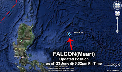
Tropical Storm FALCON/07W/Meari...now outside the PAR...accelerates further Northward at 33 kph towards the East China Sea after passing near Ishigaki City in Okinawa Prefecture, Japan. At 2am today 25 June, it is about 260 km ENE of Taipei, Taiwan just west of the Okinawa Trough. FALCON has wind gusts of up to 130 kph.

New forecast pops out! MEARI/07W shall now zigzag tracking NNW to NNE for a while over the East China Sea. The system shall cross between the Yellow Sea and Korea's West Sea before moving NE and touching land over P'yongan-bukto, North Korea. It shall move inland further crossing into Jilin Province, People's Republic of China.

At 2pm today, 25 June, FALCON shall be 355 km SE of Shanghai, China. Wind gusts shall intensify to 140 kph.

Click here for the
3-Day TROPICAL STORM FALCON/07W(Meari)
Forecast Positions & Strength


AREAS HAVING PUBLIC STORM SIGNAL WARNING

SIGNAL NO. 4
(above 185 kph winds)
SIGNAL NO. 3
(100 to 185 kph winds)
SIGNAL NO. 2
(60 - 100 kph winds)
SIGNAL NO. 1
(from 45 - 60 kph winds)
NONE NONE NONE NONE

FORECAST ANALYSIS AND EFFECTS
FALCON/07W/Meari continues to accelerate NNW after lashing the Yaeyama and Southern Ryukyu Islands particularly Ishigaki City. Its southern rainbands are still over Yaeyama and Southern Ryukyu Islands. Its northwestern vortice covers Taiwan including Southeastern China while some of its outer northeastern clouds are reaching Extreme Southern Japan. The Philippines is now under the Southwest Moonsoon spell. Weather shall return to normal in most parts of the country as FALCON pulls away.

MEARI/07W is now headed for Northwestern Korea. It shall move in a slight zigzag direction (NNE to NNW) while hovering East China Sea today until tomorrow. By early 27 June, it shall be between the Yellow Sea and West Sea.

It shall turn NE towards P'yongan-bukto, North Korea. The system shall move inland near Yongchon and shall cross Yalu River into Northeastern China. It shall continue tracking inland passing very close to Baishanshi, Jilin Province reaching to the west of Dunhua City in the Yanbian Korean Autonomous Prefecture where it shall dissipate.

FALCON shall continue to enhance the Southwest Moonsoon. Expect rains throughout the Philippines. Beware of flashfloods and landslides that could be triggered by this disturbance. Strong far-fetched sea waves can also be expected along the coasts of Luzon, Southeastern China, Taiwan, Southern Japan, Yaeyama and Ryukyu Islands. All sea vessels must be alerted.

P.S.
This will be the FINAL Advisory on this Tropical Disturbance. A new advisory will be issued once a new tropical disturbance becomes a threat to our country. Mabalos po.

•••

UPDATED SATELLITE FIX BULLETIN


===
The IMAGES below are always UPDATED:


♦♦♦ FORECAST MODELS FOCUS: FALCON/07W/MEARI ♦♦♦

CLICK TO ZOOM

===


♦♦♦ LATEST TRACKING MAP OF FALCON/07W/MEARI ♦♦♦

CLICK TO ZOOM
CLICK TO ZOOM

===


♦♦♦ LATEST WESTERN PACIFIC SATELLITE IMAGE ♦♦♦

CLICK TO ZOOM

Click here for the Latest HI-RES Satellite Image

Click here for the Latest Flash Satellite Video


===


♦♦♦ LATEST WESTERN PACIFIC RAIN RATE ♦♦♦

CLICK TO ZOOM

===


♦♦♦ LATEST WESTERN PACIFIC SURFACE WIND ♦♦♦

CLICK TO ZOOM

===


♦♦♦ LATEST PHILIPPINE WATER WAVE HEIGHT AND DIRECTION ♦♦♦

CLICK TO ZOOM

===


♦♦♦ LATEST WESTERN PACIFIC WAVE HEIGHT AND DIRECTION ♦♦♦

CLICK TO ZOOM

===


♦♦♦ LATEST WESTERN PACIFIC SEA SURFACE TEMPERATURE ♦♦♦

CLICK TO ZOOM

•••


•••

Friday, June 24, 2011

Tropical Storm FALCON/07W/Meari Weather Update as of 24 June @ 11:30pm Ph Time

Tropical Storm FALCON/07W/Meari continues to intensify as it accelerates NNW at 22 kph towards the east of Northern Taiwan in the vicinity Ishigaki City in Okinawa Prefecture, Japan...about to cross the northern Philippine Area of Responsibility (PAR). It shall transition into an Extratropical storm system in 2 days time. At 9:32pm, 24 June, it is about 480 km ENE of Basco, Batanes or 30 km ESE of Ishigaki City and some 305 km ESE Taipei, Taiwan. FALCON has wind gusts of up to 130 kph.

Forecast is still consistent with previous prognosis with slight variance in the extended track. It shows the system moving NNW to Northward gliding to the east of Taiwan very close to Ishigaki City in Okinawa Prefecture, Japan before turning NNE and poleward towards the East China Sea. FALCON shall turn NNE to NE into Korea's West Sea before touching down near Seoul, South Korea.

At 8am tomorrow, 25 June, FALCON shall be 340 km ENE of Taipei...outside of the Philippine Area of Responsibility. Wind gusts shall intensify to 140 kph.

Click here for the
3-Day TROPICAL STORM FALCON/07W(Meari)
Forecast Positions & Strength


AREAS HAVING PUBLIC STORM SIGNAL WARNING

SIGNAL NO. 4
(above 185 kph winds)
SIGNAL NO. 3
(100 to 185 kph winds)
SIGNAL NO. 2
(60 - 100 kph winds)
SIGNAL NO. 1
(from 45 - 60 kph winds)
NONE NONE NONE NONE

FORECAST ANALYSIS AND EFFECTS
FALCON/07W/Meari continues to accelerate NNW and is now lashing the Yaeyama and Southern Ryukyu Islands particularly Ishigaki City. Its southern rainbands has left Extreme Northern Luzon. The Philippines is now under the Southwest Moonsoon spell. Severe massive flooding in MARIKINA is now being experienced! Several dams in the area are now over flowing.

FALCON is still headed for Korea. It shall continue moving Northward towards Yaeyama and Southern Ryukyu Islands just east of Northern Taiwan tonight passing between Tarama Jima & Ishigako-shima Island.

In the afternoon of 25 June, FALCON shall turn NNE to Northward towards the East China Sea. It shall pass to the east of Shanghai in Eastern China. Extratropical transition shall commence while approaching Korea's West Sea. By 26 June, FALCON shall move NE approaching to the west of Cheju Do Island before veering towards Korea's West Sea. It shall glide to the western coast of South Korea passing to the west of Mokpo and Gwangju. On the night 26 June, FALCON shall make landfall over North Hwanghae Province near Seoul, South Korea. The system shall move NE into North Korea via South Hamgyŏng Province. FALCON shall pass to the southeast of Mt. Baitou Shan and shall cross border again into Yanbian Korean Autonomous Prefecture in Jilin Province, in Northeastern China by 27 June.

FALCON shall continue to enhance the Southwest Moonsoon. Expect rains throughout the Philippines. Beware of flashfloods and landslides that could be triggered by this disturbance. Strong far-fetched sea waves can also be expected along the northeastern coasts of Luzon, Taiwan, Yaeyama and Ryukyu Islands. Moderate to rough sea waves is also expected along the western coast of Luzon. All sea vessels must be alerted.

•••

UPDATED SATELLITE FIX BULLETIN


===
The IMAGES below are always UPDATED:


♦♦♦ FORECAST MODELS FOCUS: FALCON/07W/MEARI ♦♦♦

CLICK TO ZOOM

===


♦♦♦ LATEST TRACKING MAP OF FALCON/07W/MEARI ♦♦♦

CLICK TO ZOOM
CLICK TO ZOOM

===


♦♦♦ LATEST WESTERN PACIFIC SATELLITE IMAGE ♦♦♦

CLICK TO ZOOM

Click here for the Latest HI-RES Satellite Image

Click here for the Latest Flash Satellite Video


===


♦♦♦ LATEST WESTERN PACIFIC RAIN RATE ♦♦♦

CLICK TO ZOOM

===


♦♦♦ LATEST WESTERN PACIFIC SURFACE WIND ♦♦♦

CLICK TO ZOOM

===


♦♦♦ LATEST PHILIPPINE WATER WAVE HEIGHT AND DIRECTION ♦♦♦

CLICK TO ZOOM

===


♦♦♦ LATEST WESTERN PACIFIC WAVE HEIGHT AND DIRECTION ♦♦♦

CLICK TO ZOOM

===


♦♦♦ LATEST WESTERN PACIFIC SEA SURFACE TEMPERATURE ♦♦♦

CLICK TO ZOOM

•••


•••

Thursday, June 23, 2011

Tropical Storm FALCON/07W/Meari Weather Update as of 24 June @ 3:30am Ph Time

Tropical Storm FALCON/07W/Meari moving NW at 22 kph along the East Philippine Sea now located to the east of Cagayan. At 12:32am, 24 June, it is about 450 km ESE of Camiguin Island. FALCON has wind gusts of up to 90 kph. FALCON's rainbands continue to cover almost the entire Philippines as depicted in the very latest Satellite imageries.

The relocation of its center earlier did not affect the forecast prognosis which still shows the system moving NW along the Philippine Sea and gliding to the east of Extreme Northern Luzon and Taiwan directly cutting to the east of Taketomi in Yaeyama District, Okinawa, Japan before turning poleward and deviating a northeast forward movement towards the East China Sea and into Korea's West Sea before touching down into North Korea.

At 2am today, FALCON shall be 430 km ESE of Basco, Batanes. Wind gusts shall intensify to 100 kph.

Click here for the
4-Day TROPICAL STORM FALCON/07W(Meari)
Forecast Positions & Strength


AREAS HAVING PUBLIC STORM SIGNAL WARNING

SIGNAL NO. 4
(above 185 kph winds)
SIGNAL NO. 3
(100 to 185 kph winds)
SIGNAL NO. 2
(60 - 100 kph winds)
SIGNAL NO. 1
(from 45 - 60 kph winds)
NONE NONE NONE Isabela
Cagayan
Calayan
Babuyan Grp of Is
Batanes Grp of Is

FORECAST ANALYSIS AND EFFECTS
FALCON/07W/Meari's exposed, elongated eye was seen in a recent satellite pass. Very thick rainclouds with small rotating vortices continue to flare up all around the storm spurting heavy rains and winds. Strong Southwest Moonsoon is being experienced in Mindanao and other parts of the country that is being enhanced by this system.

FALCON shall remain over the East Philippine Sea and there is no immediate landfall threat to the Philippines as of this time. The storm still calls for a Korean landfall. FALCON shall continue moving NW passing to the east of Extreme Northern Luzon by 24 June and moving to the east of Taiwan via Ishigaki-shima Island by 25 June.

On 25 June, FALCON shall turn poleward to NNE towards the East China Sea missing Mainland China and just passing to the east of Shanghai in Eastern China. By 26 June, FALCON shall then turn NE towards Korea's West Sea and shall make landfall in North Korea between Choam-dong and Ch'onggye-ri and slicing through Chagun'gogae. FALCON shall pass to the southeast of Pyongyang and into the southwest of Hamhŭng, South Hamgyŏng Province by 27 June.

FALCON shall enhance the Southwest Moonsoon. Expect rains throughout the Philippines while this system hovers the East Philippine Sea. Beware of flashfloods and landslides that could be triggered by this disturbance. Strong far-fetched sea waves can also be expected along the eastern coast of Luzon being generated by this storm. All sea vessels must be alerted.

•••

UPDATED SATELLITE FIX BULLETIN


===
The IMAGES below are always UPDATED:


♦♦♦ FORECAST MODELS FOCUS: FALCON/07W/MEARI ♦♦♦

CLICK TO ZOOM

===


♦♦♦ LATEST TRACKING MAP OF FALCON/07W/MEARI ♦♦♦

CLICK TO ZOOM
CLICK TO ZOOM

===


♦♦♦ LATEST WESTERN PACIFIC SATELLITE IMAGE ♦♦♦

CLICK TO ZOOM

Click here for the Latest HI-RES Satellite Image

Click here for the Latest Flash Satellite Video


===


♦♦♦ LATEST WESTERN PACIFIC RAIN RATE ♦♦♦

CLICK TO ZOOM

===


♦♦♦ LATEST WESTERN PACIFIC SURFACE WIND ♦♦♦

CLICK TO ZOOM

===


♦♦♦ LATEST PHILIPPINE WATER WAVE HEIGHT AND DIRECTION ♦♦♦

CLICK TO ZOOM

===


♦♦♦ LATEST WESTERN PACIFIC WAVE HEIGHT AND DIRECTION ♦♦♦

CLICK TO ZOOM

===


♦♦♦ LATEST WESTERN PACIFIC SEA SURFACE TEMPERATURE ♦♦♦

CLICK TO ZOOM

•••


•••

Wednesday, June 22, 2011

Tropical Storm FALCON/07W/Meari Weather Update as of 22 June @ 11pm Ph Time

Tropical Storm FALCON/07W/Meari continues to accelerate at 27 kph and intensifies along the East Philippine Sea. The system dipped slightly WSW several hours ago. At 9:32pm, 22 June, it is about 210 km NE of Pandan, Catanduanes or 410 km ESE of Casiguran, Aurora. FALCON has wind gusts of up to 90 kph.

Forecast still shows the system to resume moving NW along the Philippine Sea and gliding very close to the east of Basco, Itbayat and Mavudis Island in Extreme Northern Luzon and also passing very close to Orchid Island before making landfall in Taiwan on the night of 24 June. A second landfall in Eastern China is also expected in the morning of 25 June.

At 8am tomorrow, FALCON shall be 275 km NE of Ilagan, Isabela or 340 km SE of Camiguin Island. Wind gusts shall intensify to 100 kph.

5-Day TROPICAL STORM FALCON/07W(Meari) Forecast Positions & Strength


AREAS HAVING PUBLIC STORM SIGNAL WARNING

Signal No. 1
Isabela
Cagayan
Calayan Group of Is.
Babuyan Group of Is.
Batanes Group of Is.

FORECAST ANALYSIS AND EFFECTS
FALCON/07W/Meari's circulation remains over water and has become better organized. It is forecast to intensify further. Satellite imageries now reveal a flaring of very thick storm clouds to the southeast and west of the circulation indicating the existence of two (2) eyes or low level circulation centers. The Philippine Sea's very warm temperature continues to fuel the storm's development. Rough seas along the coast Catanduanes is expected. Its southwestern bands continue to affect Bicol, Quezon Province, Samar and Leyte. Strong Southwest Moonsoon is being experienced in Mindanao and other parts of the country that is being enhanced by this system.

FALCON shall remain over the East Philippine Sea and there is no immediate landfall threat to the Philippines as of this forecast except for a very close pass to the east of Extreme Northern Luzon. The storm still calls for a Taiwan-Eastern China landfall. FALCON shall continue moving NW passing to the east of Extreme Northern Luzon in the morning 24 June. Landfall in Eastern Taiwan follows on the night of 24 June until the early morning of 25 June.

In Taiwan, it shall traverse Luye, Taitung County then turn NNW passing very close to Mount Yu. It shall continue moving near Guosing, Nantou County then near Dongshih, Tongluo Miaoli County and Houlong Township. It shall exit into the Southwestern part of the East China Sea and is forecast to turn north to NE.

In the morning of 25 June until 26 June, FALCON shall make its second landfall in Eastern China near Dayu Shan Island and Fuding City. It shall pass very close to Shaoxing and Jiaxing turning NE over Kunshan and Haimen Jiangsu Province. FALCON shall then move into the Yellow Sea, west of South Korea, by 27 June where it shall dissipate.

FALCON shall enhance the Southwest Moonsoon. Expect rains throughout the Philippines while this system hovers the East Philippine Sea. Beware of flashfloods and landslides that could be triggered by this disturbance. Strong far-fetched sea waves can also be expected along the eastern coast of Luzon being generated by this storm. All sea vessels must be alerted.

===

The SATELLITE IMAGES below are always UPDATED:


♦♦♦ LATEST TRACKING MAP OF FALCON/07W/MEARI ♦♦♦

CLICK TO ZOOM
CLICK TO ZOOM

===


♦♦♦ LATEST WESTERN PACIFIC SATELLITE IMAGE ♦♦♦

CLICK TO ZOOM

Click here for the Latest HI-RES Satellite Image

Click here for the Latest Flash Satellite Video


===


♦♦♦ LATEST WESTERN PACIFIC RAIN RATE ♦♦♦

CLICK TO ZOOM

===


♦♦♦ LATEST WESTERN PACIFIC SURFACE WIND ♦♦♦

CLICK TO ZOOM

===


♦♦♦ LATEST PHILIPPINE WATER WAVE HEIGHT AND DIRECTION ♦♦♦

CLICK TO ZOOM

===


♦♦♦ LATEST WESTERN PACIFIC WAVE HEIGHT AND DIRECTION ♦♦♦

CLICK TO ZOOM

===


♦♦♦ LATEST WESTERN PACIFIC SEA SURFACE TEMPERATURE ♦♦♦

CLICK TO ZOOM

•••


•••