Wednesday, August 31, 2011

PANAHON UPDATE
as of 31 August 2011 @ 6:54am Ph Time


LPA Alert:
LPA 98W ENE of Saipan far out in the Pacific Ocean.

Philippine Outlook:
Stormless until 09 September 2011 as per ECMWF forecast model.


ACTIVE TROPICAL DISTURBANCE
(Outside the Philippine Area of Responsibility)


♦♦♦ LATEST TRACKING MAP OF NANMADOL/14W/MINA ♦♦♦

CLICK TO ZOOM


♦♦♦ FORECAST MODELS FOCUS: NANMADOL/14W/(MINA) ♦♦♦

CLICK TO ZOOM

===


♦♦♦ LATEST TRACKING MAP OF TALAS/15W ♦♦♦

CLICK TO ZOOM


♦♦♦ FORECAST MODELS FOCUS: TALAS/15W ♦♦♦

CLICK TO ZOOM

===

♦♦♦ WESTERN PACIFIC SATELLITE IMAGE (approx. 3 hrs. ago) ♦♦♦

CLICK TO ZOOM

Click here for the Latest HI-RES Satellite Image

Click here for the Latest Flash Satellite Video


===


♦♦♦ LATEST WESTERN PACIFIC RAIN RATE ♦♦♦

CLICK TO ZOOM

===


♦♦♦ LATEST WESTERN PACIFIC SURFACE WIND ♦♦♦

CLICK TO ZOOM

===


♦♦♦ LATEST PHILIPPINE WATER WAVE HEIGHT AND DIRECTION ♦♦♦

CLICK TO ZOOM

===


♦♦♦ LATEST WESTERN PACIFIC WAVE HEIGHT AND DIRECTION ♦♦♦

CLICK TO ZOOM

===


♦♦♦ LATEST WESTERN PACIFIC SEA SURFACE TEMPERATURE ♦♦♦

CLICK TO ZOOM

•••

Mike's Facebook
http://www.dreambingo.co.uk/

Monday, August 29, 2011

PANAHON UPDATE
as of 29 August 2011 @ 9:16pm Ph Time


LPA Alert:
New LPA 98W forms about 1,055 km ENE of Saipan far out in the Pacific Ocean.

PANAHON ADVISORY
on Tropical Storm Nanmadol/14W/Mina
as of 29 August 2011 @ 10:57am Ph Time
(Final Advisory)


Typhoon NANMADOL/14W/MINA weakens into a Tropical Storm after traversing Southern Taiwan this morning...now located over the Taiwan Strait. At 8pm tonight, it is forecast to be some 25 km ENE of Husi, Penghu Island. Wind gusts in the area are estimated at 90 kph. MINA is forecast to move NW to WNW at 16 kph toward Fujian Province in China.

2-Day Tropical Storm NANMADOL/14W/MINA
Forecast Positions & Strength


AREAS HAVING PUBLIC STORM SIGNAL WARNING

SIGNAL NO. 4
(above 185 kph winds)
SIGNAL NO. 3
(100 to 185 kph winds)
SIGNAL NO. 2
(60 - 100 kph winds)
SIGNAL NO. 1
(from 45 - 60 kph winds)
NONE NONE NONE NONE
PAGASA Advisory as of 29 August 2011 @ 10:57pm
CLICK HERE for the Updated Storm Warning Signals.


FORECAST ANALYSIS AND EFFECTS
NANMADOL/14W/MINA's inner rainbands is still pounding Southern and Central Taiwan. Stormy weather prevails in the area. Its outer rainbands are still over Extreme Northern Luzon bringing rains and gusts over that area.

MINA shall continue moving NW to WNW now with increased speed. It shall pass to the north of Penghu Island tonight and shall be over the eastern coast of Fujian, China tomorrow night. As a weakened tropical depression, it shall pass very close to the south of Shishi and north of Tong'an moving WNW continuosly to the north of Yanxizhen. MINA shall then turn more to the
west passing south of Hua'an and Longyan before dissipating about 90 km to the north of Meizhou by 01 September.

Meanwhile, improved weather condition can now be experienced in the Philippines. Coastal areas in Extreme Northern Luzon are still moderate to rough.

With this development, this is the FINAL ADVISORY on this tropical disturbance.


♦♦♦ LATEST TRACKING MAP OF NANMADOL/14W/MINA ♦♦♦

CLICK TO ZOOM
CLICK TO ZOOM


♦♦♦ FORECAST MODELS FOCUS: NANMADOL/14W/(MINA) ♦♦♦

CLICK TO ZOOM

===

PANAHON ADVISORY
on Tropical Storm TALAS/15W
as of 29 August 2011 @ 5:10pm Ph Time
(Final Advisory)


Tropical Storm TALAS is about 165 km WSW of Iwo To, Japan. Wind gusts are estimated at 130 kph. TALAS is moving Northward at 3 kph. On 03 September, TALAS (turned Extratropical Storm) shall be over Honshu...about 235 km NNW of Tokyo, Japan with wind gusts of 120 kph.

Tropical Storm TALAS is not a threat to the Philippines and is expected to pass just to the east of the Philippine Area of Responsiblity. With this development, this is the FINAL ADVISORY on this tropical disturbance.


♦♦♦ LATEST TRACKING MAP OF TALAS/15W ♦♦♦

CLICK TO ZOOM
CLICK TO ZOOM


♦♦♦ FORECAST MODELS FOCUS: TALAS/15W ♦♦♦

CLICK TO ZOOM

===

♦♦♦ WESTERN PACIFIC SATELLITE IMAGE (approx. 3 hrs. ago) ♦♦♦

CLICK TO ZOOM

Click here for the Latest HI-RES Satellite Image

Click here for the Latest Flash Satellite Video


===


♦♦♦ LATEST WESTERN PACIFIC RAIN RATE ♦♦♦

CLICK TO ZOOM

===


♦♦♦ LATEST WESTERN PACIFIC SURFACE WIND ♦♦♦

CLICK TO ZOOM

===


♦♦♦ LATEST PHILIPPINE WATER WAVE HEIGHT AND DIRECTION ♦♦♦

CLICK TO ZOOM

===


♦♦♦ LATEST WESTERN PACIFIC WAVE HEIGHT AND DIRECTION ♦♦♦

CLICK TO ZOOM

===


♦♦♦ LATEST WESTERN PACIFIC SEA SURFACE TEMPERATURE ♦♦♦

CLICK TO ZOOM

•••

Mike's Facebook
http://www.dreambingo.co.uk/

PANAHON UPDATE
on Tropical Storm Nanmadol/14W/Mina
as of 29 August 2011 @ 8:42am Ph Time


MINA (now outside the PAR) weakens into a Tropical Storm and is now over Taiwan Strait after traversing Southern Taiwan in Tainan near Cigu and Yongkang. It is now over the island of Penghu near Magong and Husi. The recent movement of MINA is slightly to the south of the previous forecast. Expect PAGASA to lower all storm signals in their upcoming advisory today. Improving weather condition shall begin in Extreme Northern Luzon as MINA continues to pull away toward Fujian, China.

PANAHON ADVISORY
on Typhoon Nanmadol/14W/Mina
as of 29 August 2011 @ 5:37am Ph Time


Typhoon NANMADOL/14W/MINA weakens into a Category 1 Typhoon and is now making landfall in the southern tip of Taiwan...now located some 25 km SE of Daren, Taitung County in Taiwan or about 210 km NW of Basco, Batanes. Wind gusts in the area are estimated at 155 kph. MINA is forecast to move Northward to NNW at 11 kph toward Mainland Taiwan. An extended forecast shows MINA turning to the west into Southeastern China where it shall dissipate by 02 September.

3-Day Typhoon NANMADOL/14W/MINA
Forecast Positions & Strength


AREAS HAVING PUBLIC STORM SIGNAL WARNING

SIGNAL NO. 4
(above 185 kph winds)
SIGNAL NO. 3
(100 to 185 kph winds)
SIGNAL NO. 2
(60 - 100 kph winds)
SIGNAL NO. 1
(from 45 - 60 kph winds)
NONE NONE Batanes Grp of Is. Babuyan &
Calayan Grp of Is.
PAGASA Advisory as of 29 August 2011 @ 5:36am
CLICK HERE for the Updated Storm Warning Signals.


FORECAST ANALYSIS AND EFFECTS
NANMADOL/14W/MINA's inner rainbands has started to lash Southern Taiwan. Its outer rainbands are still over Extreme Northern Luzon bringing rains and gusts over that area. In Taiwan, MINA shall make landfall very near Daren today and it shall move NNW into Majia, Sandimen, Gaoshu, Meinong and Dongshan. MINA shall turn NW into Houbi, Lucao, Puzih and Lioujiao. TAIWAN interaction shall further weaken the system down to a Tropical Storm. It shall exit into Taiwan Strait via Kouho tonight. MINA shall move WNW into Fujian Province in China near Shishi on 30 August. It shall continue moving inland as a weak Tropical Depression to the north of Tong'an, Lianhuazhen and Longyan where its shall dissipate by 02 September.

Meanwhile, improved weather condition can now be experienced in the Philippines. Coastal areas in Extreme Northern Luzon are still moderate to rough.


♦♦♦ LATEST TRACKING MAP OF NANMADOL/14W/MINA ♦♦♦

CLICK TO ZOOM
CLICK TO ZOOM


♦♦♦ FORECAST MODELS FOCUS: NANMADOL/14W/(MINA) ♦♦♦

CLICK TO ZOOM

===

PANAHON ADVISORY
on Tropical Storm TALAS/15W
as of 29 August 2011 @ 5:49am Ph Time


Tropical Storm TALAS is about 175 km WSW of Iwo To, Japan. Wind gusts are estimated at 130 kph. TALAS is moving NNE at 7 kph. On 03 September, TALAS shall make landfall in Shizuoka, Shizuoka Prefecture, Japan or about 155 km WSW of Tokyo, Japan with wind gusts of 165 kph.

Tropical Storm TALAS is not a threat to the Philippines and is expected to pass just to the east of the Philippine Area of Responsiblity.


♦♦♦ LATEST TRACKING MAP OF TALAS/15W ♦♦♦

CLICK TO ZOOM
CLICK TO ZOOM


♦♦♦ FORECAST MODELS FOCUS: TALAS/15W ♦♦♦

CLICK TO ZOOM

===

LPA Alert:
New LPA 98W forms about 1,075 km ENE of Saipan far out in the Pacific Ocean.

===

♦♦♦ WESTERN PACIFIC SATELLITE IMAGE (approx. 3 hrs. ago) ♦♦♦

CLICK TO ZOOM

Click here for the Latest HI-RES Satellite Image

Click here for the Latest Flash Satellite Video


===


♦♦♦ LATEST WESTERN PACIFIC RAIN RATE ♦♦♦

CLICK TO ZOOM

===


♦♦♦ LATEST WESTERN PACIFIC SURFACE WIND ♦♦♦

CLICK TO ZOOM

===


♦♦♦ LATEST PHILIPPINE WATER WAVE HEIGHT AND DIRECTION ♦♦♦

CLICK TO ZOOM

===


♦♦♦ LATEST WESTERN PACIFIC WAVE HEIGHT AND DIRECTION ♦♦♦

CLICK TO ZOOM

===


♦♦♦ LATEST WESTERN PACIFIC SEA SURFACE TEMPERATURE ♦♦♦

CLICK TO ZOOM

•••

Mike's Facebook
http://www.dreambingo.co.uk/

Sunday, August 28, 2011

PANAHON UPDATE
on Typhoon Nanmadol/14W/Mina
as of 28 August 2011 @ 4:43pm Ph Time


TY MINA resumes its NNW movement at 12 kph... now about 105 km WNW of Basco, Batanes with peak gusts of 195 kph near the center. The extended forecast still shows MINA moving into Southern and Central Taiwan by 29 August and eventually moving westward to WSW into Fujian Province near Xiamen in Southeastern China on 31 August! MINA is forecast to exit the PAR by 30 August. Dissipation inland over Guandong Province is expected on 01 September. Please refer to the LATEST TRACKING MAP.


PANAHON ADVISORY
on Typhoon Nanmadol/14W/Mina
as of 28 August 2011 @ 6:23am Ph Time


Typhoon NANMADOL/14W/MINA is still a strong Category 3 Typhoon...now located to the north of Camiguin Island over the Balintang Channel. It is about 110 km WSW of Basco, Batanes or 185 km NE of Laoag City. Wind gusts in the area are estimated at 230 kph. MINA is forecast to move NW at 9 kph toward Taiwan. An extended forecast shows MINA dissipating over Northern Taiwan by 02 September.

4-Day Typhoon NANMADOL/14W/MINA
Forecast Positions & Strength


AREAS HAVING PUBLIC STORM SIGNAL WARNING

SIGNAL NO. 4
(above 185 kph winds)
SIGNAL NO. 3
(100 to 185 kph winds)
SIGNAL NO. 2
(60 - 100 kph winds)
SIGNAL NO. 1
(from 45 - 60 kph winds)
NONE Batanes Grp of Is.
Babuyan Grp of Is.
Calayan Grp of Is.
Ilocos Norte
Rest of Northern Cagayan
Apayao
Abra
Ilocos Sur
PAGASA Advisory as of 28 August 2011 @ 6:08pm
CLICK HERE for the Updated Storm Warning Signals.


FORECAST ANALYSIS AND EFFECTS
NANMADOL/14W/MINA's inner rainbands continue to pound the islands in Extreme Northern Luzon. MINA's outerbands is now reaching Southern Taiwan and is still covering much of Central Luzon. The system has just brushed Calayan Island and is now expected to move to the west of the Batanes Group of Islands today. Expect stormy weather over these areas. There is a possibility that the system shall slightly reintensify to Category 4 Typhoon Status while moving northward toward Taiwan with peak wind gusts of 260 kph! The Southwest Moonsoon shall likewise be pulled by this system bringing rainy and windy conditions across the rest of the Philippines. Beware of flashfloods and landslides. MINA shall make landfall in Taiwan by 30 August.

In Taiwan, MINA shall make landfall very near to the west of Taitung by 30 August. It shall move northward toward Haiduan passing to the east of Mount Yu where MINA shall start to move NW into Sinyi Township, Puli, Guosing, Dongshih and Yuanli before exiting into Taiwan Strait in Northwestern Taiwan by 01 September.

Meanwhile, improved weather condition can now be experienced in Southern Luzon and the rest of the country as MINA pulls away.

Please note that MINA is a very dangerous typhoon. Residents in Northern Luzon should exercise extreme caution! Coastal areas along the eastern seaboard of Luzon shall be very rough.


♦♦♦ LATEST TRACKING MAP OF NANMADOL/14W/MINA ♦♦♦

CLICK TO ZOOM
CLICK TO ZOOM


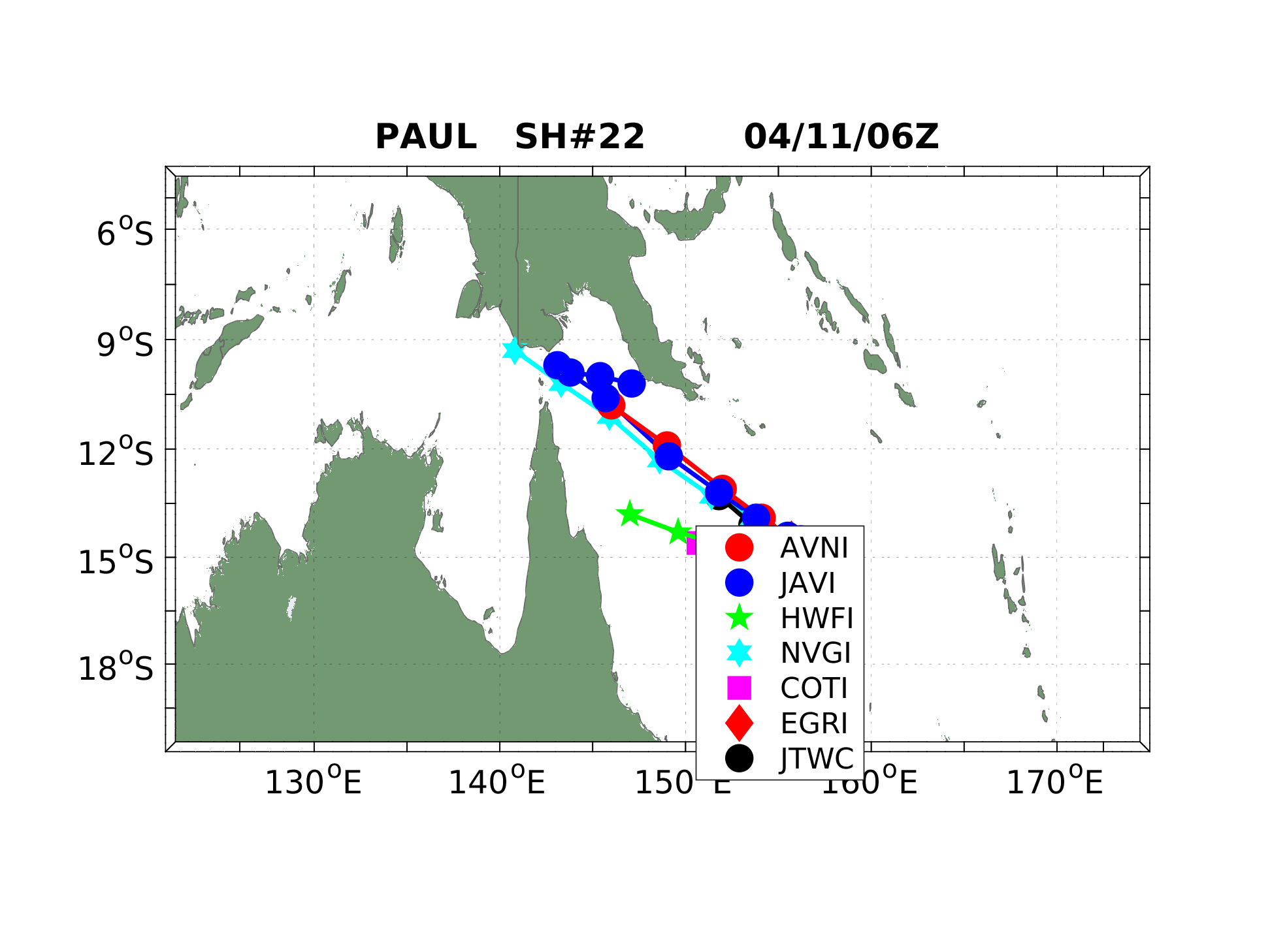
♦♦♦ FORECAST MODELS FOCUS: NANMADOL/14W/(MINA) ♦♦♦
CLICK TO ZOOM

===

PANAHON ADVISORY
on Tropical Storm TALAS/15W
as of 28 August 2011 @ 6:23am Ph Time


Tropical Storm TALAS is about 270 km WSW of Iwo To, Japan. Wind gusts are estimated at 100 kph. TALAS is stationary at the moment but is forecast to continue moving NNW. On 02 September, TALAS shall be about 520 km South of Tokyo, Japan with wind gusts of 185 kph.

Tropical Storm TALAS is not a threat to the Philippines and is expected to pass just to the east of the Philippine Area of Responsiblity.


♦♦♦ LATEST TRACKING MAP OF TALAS/15W ♦♦♦

CLICK TO ZOOM
CLICK TO ZOOM


♦♦♦ FORECAST MODELS FOCUS: TALAS/15W ♦♦♦

CLICK TO ZOOM

===

♦♦♦ WESTERN PACIFIC SATELLITE IMAGE (approx. 3 hrs. ago) ♦♦♦

CLICK TO ZOOM

Click here for the Latest HI-RES Satellite Image

Click here for the Latest Flash Satellite Video


===


♦♦♦ LATEST WESTERN PACIFIC RAIN RATE ♦♦♦

CLICK TO ZOOM

===


♦♦♦ LATEST WESTERN PACIFIC SURFACE WIND ♦♦♦

CLICK TO ZOOM

===


♦♦♦ LATEST PHILIPPINE WATER WAVE HEIGHT AND DIRECTION ♦♦♦

CLICK TO ZOOM

===


♦♦♦ LATEST WESTERN PACIFIC WAVE HEIGHT AND DIRECTION ♦♦♦

CLICK TO ZOOM

===


♦♦♦ LATEST WESTERN PACIFIC SEA SURFACE TEMPERATURE ♦♦♦

CLICK TO ZOOM

•••


•••
Published with Blogger-droid v1.7.4