
At 2am tomorrow 18 June, it shall be 430 km ESE of Sorsogon or 525 km ESE of Naga City/CWC. Wind gusts are estimated to intensify to 75 kph.
Looks like a rainy Miley Cyrus concert in Manila tonight and also a rainy Birth Anniversary of our National Hero -- Dr. Jose Rizal.
5-Day TROPICAL DEPRESSION EGAY(06W) Forecast Positions
AREAS HAVING PUBLIC STORM SIGNAL WARNING
Signal # 1Catanduanes
Sorsogon
Samar Provvinces
•••
FORECAST ANALYSIS AND EFFECTS
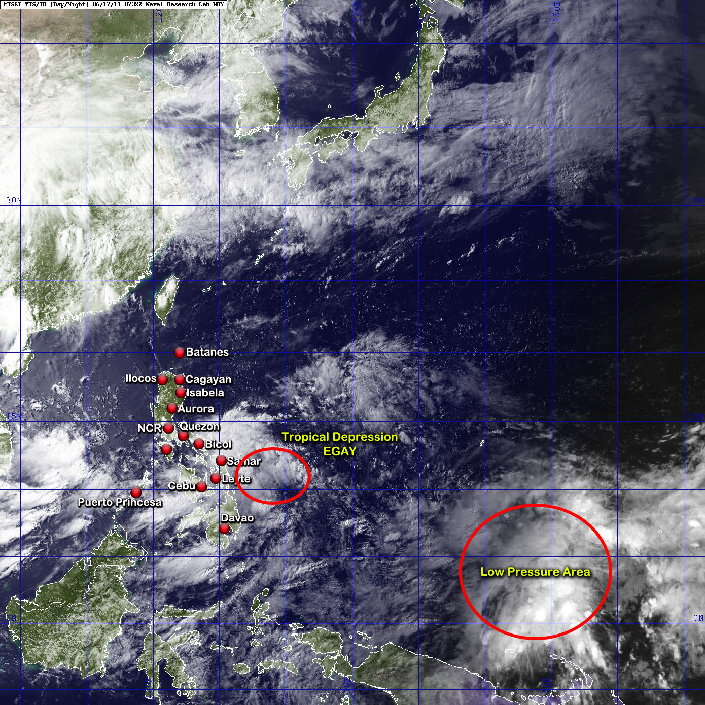
TD EGAY has now a partially exposed eye. Its very big circulation is now covering the entire Visayas, Mindanao and Bicol region with scattered rain clouds affecting Manila and Quezon Province. The system picked up speed earlier but is forecast to slow down again in the coming hours. Deteriorating weather is now being experienced in Visayas, Mindanao, the Bicol region, parts of Quezon Province and Manila. The southwest moonsoon shall be enhanced by this system.
Forecast Models continue to track the system to move NW over the East Philippine Sea until 20 June. It shall intensify with windgusts at 85kph by 19 June. Data shows that its closest approach to Cagayan (Sta. Ana and Palaui Island) is sometime on 20 June. During this time, EGAY shall continue to intensify slightly before crossing the Balintang Channel, between Babuyan and Balintang Island on the night of 20 June or early morning of 21 June. Before exiting, EGAY's gusts should have reached up to 90 kph. The system shall exit the Philippine Area of Responsibility sometime during the night of 21 June or early morning of 22 June.
Expect deteriorationg weather along the eastern portion of Luzon beginning 19 June as the system approaches.
Meanwhile, another Low Pressure Area (99W) has persisted over the Caroline Islands some 1,425 km ESE of Koror, Palau.
===
TRACKING MAP OF TROPICAL DEPRESSION EGAY(06W)

===
SATELLITE IMAGE as of 17 June @ 2:32pm
===
===
•••
 |
|---|
•••
No comments:
Post a Comment