
LPA Alert:
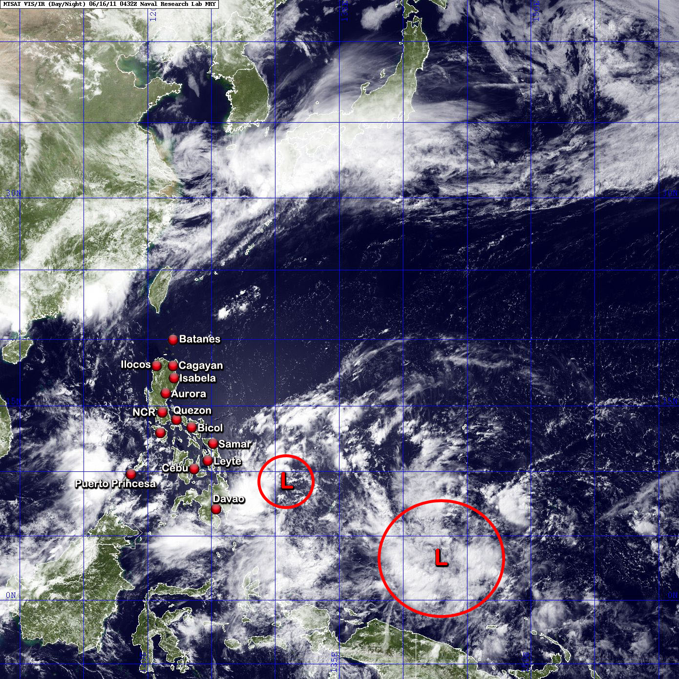
The Low Pressure Area (97W/Pre-EGAY) east of Mindanao has started to intensify. It is about 245 km ESE of Cagwait, Surigao del Sur. Winds are estimated at 37 kph. Models are now tracking the system. Data shows that it shall just hover over water in the East Philippine Sea in the next few days (sometime from 17 to 25 June). Some models track the system to the east of Taiwan, while the other models favor a Cagayan-Northern Ilocos landfall. UK Model is the southern outlier tracking the system near Catanduanes and Aurora. When this system strengthens into a Tropical Depression, PAGASA shall name it EGAY.
Meanwhile, a new Low Pressure Area (98W) has persisted way far east of the Philippine Area of Responsibility. It is located some 795 km SE of Koror, Palau moving WNW slowly. Winds in the area are estimated at 27 kph.
We shall be keeping an eye on these disturbances.
Rains shall prevail over Mindanao in the presence the LPA east of Surigao del Sur combined with the strong Intertropical Convergence Zone. The rest of the country will be fair with some isolated rainshowers and/or thunderstorms. Stay tuned for updates.
Scroll down for the latest atmospheric and oceanic imageries.
•••
===

===
===
•••
 |
|---|
•••
No comments:
Post a Comment